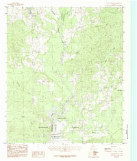
1984 Map of Chireno South
USGS Topo · Published 1984About this map
The Attoyac River serves as the dividing line between Nacogdoches and San Augustine counties, carving a winding path through a landscape dominated by the southern reaches of the Angelina National Forest. This 1984 provisional edition highlights the expansion of the Sam Rayburn Reservoir at the southern edge of the quadrangle, where the river's flow begins to back up into wider waters. Small community centers such as Chireno, Peterson, Goodwin, and Johnson are scattered across the higher ground, connected by a network of rural roads that navigate around numerous drainage systems like Amaladeros Creek, Lick Creek, and Logroulle Creek. The map provides a look at East Texas timberlands and riparian zones just before significant modern development, capturing the specific geography of small-scale settlements situated near the confluence of the river and its many named branches.
Find a feature on this map
23 named features on this map. Tap any name to fly to it.
Don’t see what you’re looking for? This feature index may not catch every label — zoom into the map to look around manually.
Map Details
Editions of this 1984 Chireno South Map
This is the sole edition of this map. No revisions or reprints were ever made.
Other maps of this area

1953 · Palestine
USGS Topo · 1:250,000

1957 · Palestine
USGS Topo · 1:250,000

1958 · Broaddus
USGS Topo · 1:62,500

1958 · San Augustine
USGS Topo · 1:62,500

1958 · Martinsville
USGS Topo · 1:62,500

1958 · Bronson
USGS Topo · 1:62,500

1984 · Norwood
USGS Topo · 1:24,000
1984 · Etoile North
USGS Topo · 1:24,000
1984 · Harvey Creek
USGS Topo · 1:24,000

1984 · Palestine
USGS Topo · 1:250,000