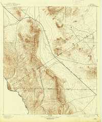
1897 Map of Chispa
USGS Topo · Published 1938About this map
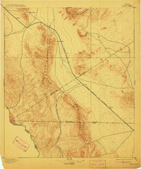
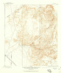
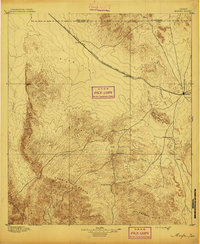
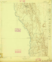
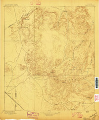
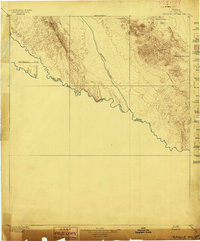
Van Horn Wells and the mountain passes of the Trans-Pecos dominate this late nineteenth-century survey, conducted just as rail networks began to redefine West Texas transit. The corridor between the Van Horn Mountains and the Wylie Mountains serves as a critical artery, carrying the Southern Pacific R. R. through a series of isolated stops including Dalberg, Arno, and Fay. To the south, the terrain descends sharply toward the Rio Grande, where the international border with Mexico meets the rugged breaks of the Sierra Vieja Mountains.
Find a feature on this map
22 named features on this map. Tap any name to fly to it.
Don’t see what you’re looking for? This feature index may not catch every label — zoom into the map to look around manually.
Map Details
Editions of this 1897 Chispa Map
3 editions found
Other maps of this area

1892 · Chispa
USGS Topo · 1:125,000
1894 · Valentine
USGS Topo · 1:125,000

1895 · Chispa
USGS Topo · 1:125,000
1895 · Marfa
USGS Topo · 1:125,000

1895 · Sierra Blanca
USGS Topo · 1:125,000
1896 · San Carlos
USGS Topo · 1:125,000
1897 · Valentine
USGS Topo · 1:125,000
1897 · Eagle Mountain
USGS Topo · 1:125,000

1897 · Chispa
USGS Topo · 1:125,000

1906 · Van Horn
USGS Topo · 1:125,000