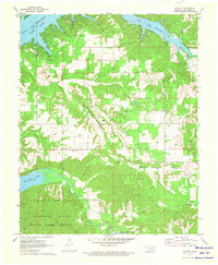
1971 Map of Chloeta
USGS Topo · Published 1973About this map
Chloeta and the surrounding Delaware County landscape are defined by the convergence of major water projects and upland timber in the early 1970s. The northern reaches of the map are dominated by the deep inlets of Lake O' the Cherokees along the Neosho River, while the southern portion features the State Game Refuge within the Spavinaw Hills. This era of Oklahoma history shows a transition from traditional rural settlements to recreation and managed wilderness, evidenced by the proximity of Yellow Tree Cem and Mose Ridge Cem to modern landmarks like the Double J Ranch Airfield. The map preserves the specific locations of community centers such as Free Holiness Ch and the small residential pocket of Eucha near the shores of Lake Eucha. A network of unimproved roads and fine fence lines, recorded from 1970 aerial photography, provides a granular view of property boundaries and local transit before further regional development.
Find a feature on this map
26 named features on this map. Tap any name to fly to it.
Don’t see what you’re looking for? This feature index may not catch every label — zoom into the map to look around manually.
Map Details
Editions of this 1971 Chloeta Map
2 editions found
Other maps of this area

1896 · Pryor
USGS Topo · 1:125,000

1899 · Siloam Springs
USGS Topo · 1:125,000

1901 · Vinita
USGS Topo · 1:125,000

1901 · Pryor
USGS Topo · 1:125,000

1903 · Siloam Springs
USGS Topo · 1:125,000

1904 · Siloam Springs
USGS Topo · 1:125,000

1907 · Wyandotte
USGS Topo · 1:125,000

1909 · Wyandotte
USGS Topo · 1:125,000

1913 · Vinita
USGS Topo · 1:125,000

1954 · Tulsa
USGS Topo · 1:250,000