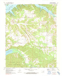
1971 Map of Chloeta
USGS Topo · Published 1991About this map
Lake O' The Cherokees and Spavinaw Lake dominate this portion of Delaware County, defining a landscape shaped by significant water management and conservation. The topography transitions from the high-elevation shores of the Neosho River down through the Spavinaw Hills, much of which is preserved within the Spavinaw Hills State Game Refuge. Small rural communities and family landmarks are scattered across the uplands, including Chloeta, Eucha, and Summerfield. Local history is anchored by sites like Mose Ridge Cemetery and Yellow Tree Church, which sit near the winding Round Spring Hollow. The presence of the Double J Ranch Airfield and a cross-country pipeline reflect the mid-century infrastructure supporting this rural corner of Oklahoma.
Find a feature on this map
22 named features on this map. Tap any name to fly to it.
Don’t see what you’re looking for? This feature index may not catch every label — zoom into the map to look around manually.
Map Details
Editions of this 1971 Chloeta Map
2 editions found
Other maps of this area

1896 · Pryor
USGS Topo · 1:125,000

1899 · Siloam Springs
USGS Topo · 1:125,000

1901 · Vinita
USGS Topo · 1:125,000

1901 · Pryor
USGS Topo · 1:125,000

1903 · Siloam Springs
USGS Topo · 1:125,000

1904 · Siloam Springs
USGS Topo · 1:125,000

1907 · Wyandotte
USGS Topo · 1:125,000

1909 · Wyandotte
USGS Topo · 1:125,000

1913 · Vinita
USGS Topo · 1:125,000

1954 · Tulsa
USGS Topo · 1:250,000