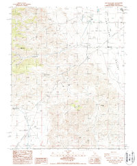
1988 Map of Chocolate Mtn
USGS Topo · Published 1988About this map
Ruins White Mountain City (Site) stands as a focal point of historical interest in this high-desert landscape on the border of California and Nevada. In the late 1980s, this area reflects a remote industrial and agricultural character, with numerous mining operations such as the Copper Queen Mine and Prospects Buck Mine dotting the terrain of Chocolate Mountain. The presence of the Deep Springs Highway Maintenance Station and a Sanitary Disposal Site indicates the sparse but essential infrastructure required to maintain this isolated stretch of Fish Lake Valley.
Find a feature on this map
24 named features on this map. Tap any name to fly to it.
Don’t see what you’re looking for? This feature index may not catch every label — zoom into the map to look around manually.
Map Details
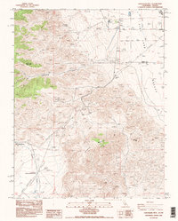
Editions of this 1988 Chocolate Mtn Map
2 editions found
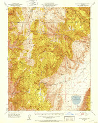
Other maps of this area

1898 · Silver Peak
USGS Topo · 1:125,000

1900 · Silver Peak
USGS Topo · 1:125,000

1908 · Lida
USGS Topo · 1:250,000

1913 · Bishop
USGS Topo · 1:125,000

1913 · Lida
USGS Topo · 1:250,000

1917 · White Mountain
USGS Topo · 1:125,000

1947 · Mariposa
USGS Topo · 1:250,000

1948 · Mariposa
USGS Topo · 1:250,000
1951 · Blanco Mountain
USGS Topo · 1:62,500

1954 · Goldfield
USGS Topo · 1:250,000