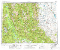
1976 Map of Choteau
USGS Topo · Published 1976About this map
Choteau and the surrounding high plains transition into the dramatic Front Range of the Rockies in this mid-1970s topographic record. The landscape is defined by the massive block of the Bob Marshall Wilderness and the Scapegoat Wilderness, areas where the Continental Divide snakes through peaks like Silvertip Mountain and Pentagon Mountain. East of the mountain front, the economy of the plains is visible through an extensive network of irrigation features including the Gibson Reservoir, Pishkun Reservoir, and Bynum Reservoir, which support agricultural communities like Fairfield and Bynum. The Great Northern Railway corridor serves as a vital artery for the region, connecting the county seat of Choteau with northern outposts like Farmington. From the dense timber of the Swan River State Forest to the open rangeland near Wolf Creek, the map captures the physical reality of Montana before the modern expansion of these gateways to the wilderness.
Find a feature on this map
218 named features on this map. Tap any name to fly to it.
Don’t see what you’re looking for? This feature index may not catch every label — zoom into the map to look around manually.
Map Details
Editions of this 1976 Choteau Map
This is the sole edition of this map. No revisions or reprints were ever made.
Other maps of this area

1886 · Great Falls
USGS Topo · 1:250,000

1886 · Fort Logan
USGS Topo · 1:250,000

1889 · Helena
USGS Topo · 1:250,000

1893 · Helena
USGS Topo · 1:250,000

1899 · Helena
USGS Topo · 1:250,000

1902 · Ovando
USGS Topo · 1:125,000

1903 · Saypo
USGS Topo · 1:125,000

1903 · Coopers Lake
USGS Topo · 1:125,000

1903 · Bonner
USGS Topo · 1:125,000

1903 · Helena
USGS Topo · 1:250,000