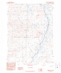
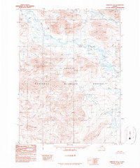
1990 Map of Christian C-5
USGS Topo · Published 1990About this map
The Arctic National Wildlife Refuge dominates this subarctic landscape in the northeastern interior of Alaska. The area is defined by the winding course of the East Fork Chandalar River, which serves as a primary drainage corridor through the hills. This 1990 provisional edition, based on aerial photography from the early 1980s, reflects the land management changes following the Alaska National Interest Lands Conservation Act. Evidence of seasonal passage through the backcountry is seen in the Winter Trail located in the northeast corner of the quadrangle. Significant elevation markers include Big Rock Mountain and Little Rock Mountain, which overlook the complex network of drainage systems like Lush Creek. The map captures a moment when federal reservation boundaries were being finalized across this remote portion of the Brooks Range foothills.
Find a feature on this map
6 named features on this map. Tap any name to fly to it.
Don’t see what you’re looking for? This feature index may not catch every label — zoom into the map to look around manually.
Map Details
Editions of this 1990 Christian C-5 Map
This is the sole edition of this map. No revisions or reprints were ever made.
Other maps of this area

1951 · Christian
USGS Topo · 1:250,000

1956 · Christian
USGS Topo · 1:250,000
1990 · Christian C-4
USGS Topo · 1:63,360
1990 · Christian C-6
USGS Topo · 1:63,360
1990 · Christian B-6
USGS Topo · 1:63,360
1990 · Christian D-4
USGS Topo · 1:63,360
1990 · Christian D-5
USGS Topo · 1:63,360
1990 · Christian B-4
USGS Topo · 1:63,360
1990 · Christian B-5
USGS Topo · 1:63,360
1990 · Christian D-6
USGS Topo · 1:63,360