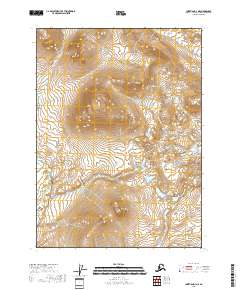
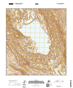
2018 Map of Christian D-3 NE
USGS Topo · Published 2018About this map
The Christian River flows through this interior region of the Yukon-Koyukuk Census Area, marking the western reaches of a landscape defined by dramatic elevation changes. The terrain is dominated by the massive landform known as Choizatdhah, which rises sharply between the river and the eastern boundaries of the quadrangle. This 2018 survey illustrates a remote wilderness where the physical topography remains the primary feature, devoid of developed roads or permanent settlements. The mapping reflects the complex township and range system, specifically covering parts of t37n r11e and t36n r12e, where surveyors have documented the intricate drainage patterns that feed into the larger river system of the Alaskan interior.
Find a feature on this map
8 named features on this map. Tap any name to fly to it.
Don’t see what you’re looking for? This feature index may not catch every label — zoom into the map to look around manually.
Map Details
Editions of this 2018 Christian D-3 NE Map
This is the sole edition of this map. No revisions or reprints were ever made.
Other maps of this area

1951 · Christian
USGS Topo · 1:250,000

1951 · Arctic
USGS Topo · 1:250,000

1956 · Arctic
USGS Topo · 1:250,000

1956 · Christian
USGS Topo · 1:250,000

1972 · Arctic A-3
USGS Topo · 1:63,360
1972 · Christian D-2
USGS Topo · 1:63,360
1972 · Christian D-3
USGS Topo · 1:63,360

1972 · Arctic A-2
USGS Topo · 1:63,360
2018 · Christian D-2 NW
USGS Topo · 1:25,000
2018 · Arctic A-2 SW
USGS Topo · 1:25,000