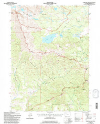
1991 Map of Christina Lake
USGS Topo · Published 1997About this map
Shoshone National Forest and the Wind River Mountains dominate this high-altitude landscape in Fremont County, where the Continental Divide separates vast alpine watersheds. The hydrology of the region is intricately mapped, featuring the headwaters of the Little Popo Agie River and the Sweetwater River, alongside prominent alpine bodies like Christina Lake and Louis Lake. A significant historic transportation corridor is preserved here via the Lander Pinedale Road, which traverses the southern portion of the sheet near Anderson Ridge. The map details the transition between the Bridger Wilderness and the national forest, marked by a series of formidable summits including Atlantic Peak and Granite Peak. Notable historic routes for packers and hikers are also recorded, such as the Sioux Pass Trail and the crossing at Christina Pass, providing a detailed look at the backcountry infrastructure of the early 1990s.
Find a feature on this map
35 named features on this map. Tap any name to fly to it.
Don’t see what you’re looking for? This feature index may not catch every label — zoom into the map to look around manually.
Map Details
Editions of this 1991 Christina Lake Map
This is the sole edition of this map. No revisions or reprints were ever made.
Other maps of this area

1953 · Sweetwater Gap
USGS Topo · 1:24,000

1953 · Cony Mountain
USGS Topo · 1:24,000

1953 · Fossil Hill
USGS Topo · 1:24,000

1953 · Louis Lake
USGS Topo · 1:24,000

1953 · South Pass City
USGS Topo · 1:24,000

1953 · Christina Lake
USGS Topo · 1:24,000

1955 · Lander
USGS Topo · 1:250,000

1958 · Lander
USGS Topo · 1:250,000

1958 · Parting of the Ways
USGS Topo · 1:62,500

1961 · Lander
USGS Topo · 1:250,000