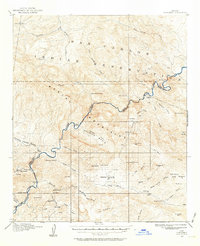
1915 Map of Christmas
USGS Topo · Published 1964About this map
The mining settlement of Christmas serves as a focal point for this 1915 survey of the Gila and Pinal County borderlands. At this time, the region was defined by a rugged mining economy, evidenced by several specialized operations including the Two Queens Mine, Pools Mine, and the Lower Coal Field Mine. The Gila River cuts through the center of the landscape, passing through the narrow Needles Eye and marking the southern boundary of the San Carlos Indian Reservation. Remote outposts like Dettles Ranch and Mings Ranch appear alongside industrial remnants like the Old Mill near Ash creek. The topography transitions from the high peaks of the Mescal Mountains down into Granite Basin and Reed Basin, illustrating the isolated network of springs and canyons that supported early Arizona prospecting and ranching before large-scale modernization.
Find a feature on this map
59 named features on this map. Tap any name to fly to it.
Don’t see what you’re looking for? This feature index may not catch every label — zoom into the map to look around manually.
Map Details
Editions of this 1915 Christmas Map
2 editions found
Other maps of this area

1901 · Globe
USGS Topo · 1:62,500

1902 · Globe
USGS Topo · 1:62,500

1910 · Ray
USGS Topo · 1:62,500

1911 · Winkelman
USGS Topo · 1:125,000

1913 · Winkelman
USGS Topo · 1:125,000

1915 · Christmas
USGS Topo · 1:62,500

1917 · Christmas
USGS Topo · 1:62,500

1938 · Klondyke
USGS Topo · 1:48,000

1943 · Klondyke
USGS Topo · 1:62,500

1949 · Holy Joe Peak
USGS Topo · 1:62,500