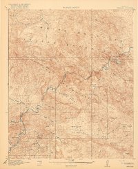
1917 Map of Christmas
USGS Topo · Published 1917About this map
Mining and ranching activity define the landscape of the Gila River corridor during the First World War. The copper settlement at Christmas serves as a primary hub, supported by the Arizona Eastern railroad winding through the river canyon. Industrial development is evident at the Lees Mine, Two Queens Mine, and Pools Mines, while the Lower Coal Field Mine suggests the diversification of local extraction.
Find a feature on this map
58 named features on this map. Tap any name to fly to it.
Don’t see what you’re looking for? This feature index may not catch every label — zoom into the map to look around manually.
Map Details
Editions of this 1917 Christmas Map
3 editions found
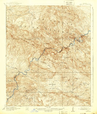
Other maps of this area

1901 · Globe
USGS Topo · 1:62,500

1902 · Globe
USGS Topo · 1:62,500

1910 · Ray
USGS Topo · 1:62,500

1911 · Winkelman
USGS Topo · 1:125,000

1913 · Winkelman
USGS Topo · 1:125,000

1915 · Christmas
USGS Topo · 1:62,500

1917 · Christmas
USGS Topo · 1:62,500

1938 · Klondyke
USGS Topo · 1:48,000

1943 · Klondyke
USGS Topo · 1:62,500

1949 · Holy Joe Peak
USGS Topo · 1:62,500