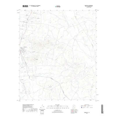
2019 Map of Christoval
USGS Topo · Published 2019About this map
Christoval anchors the western edge of this landscape where the S Concho River and the S Concho Irrigation Canal define the local water management. The terrain shifts from the flat stretches of Stonewall Valley in the north to the prominent elevation of Brushy Knob further south. For those researching family history in Tom Green County, the Delong Cem is a significant landmark near the intersection of W FM 2335 and Leal Rd. Numerous waterways like Pecan Cr, Walnut Cr, and Millers Br cut through the draws, including Mckildrick Draw. The map also captures several natural springs and summits, such as Anson Spring and Mtn Susan, reflecting a varied topography used for ranching and transit along routes like Toe Nail Trl and Ranch Rd 2084.
Find a feature on this map
35 named features on this map. Tap any name to fly to it.
Don’t see what you’re looking for? This feature index may not catch every label — zoom into the map to look around manually.
Map Details
Editions of this 2019 Christoval Map
This is the sole edition of this map. No revisions or reprints were ever made.
Other maps of this area

1892 · San Angelo
USGS Topo · 1:125,000

1895 · Sherwood
USGS Topo · 1:125,000

1924 · San Angelo 2-c
USGS Topo · 1:48,000

1924 · Sherwood 1-d
USGS Topo · 1:48,000

1928 · Wall
USGS Topo · 1:62,500

1928 · Tankersly
USGS Topo · 1:62,500

1954 · San Angelo
USGS Topo · 1:250,000

1957 · Knickerbocker
USGS Topo · 1:62,500

1957 · Wall
USGS Topo · 1:62,500

1958 · San Angelo
USGS Topo · 1:250,000