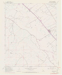
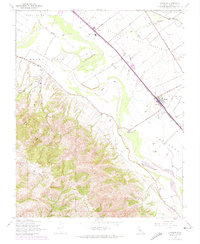
1947 Map of Chualar
USGS Topo · Published 1969About this map
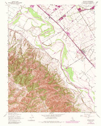
The Salinas River meanders through this portion of the valley, separating the level agricultural fields of Llano De Buena Vista from the rising foothills of the Sierra De Salinas. The settlement of Chualar sits at a critical junction where the Southern Pacific railroad and early highways provided a shipping point for the region's produce. This map, based on 1945 photography with 1968 revisions, reveals the deep Spanish-Mexican land grant heritage of Monterey County through labeled tracts like Encinal Y Buena Esperanza and Guadalupe Y Llanitos De Los Correos. Local education and safety are anchored by the Buena Vista School and the MT TORO Ranger Station, while smaller rural nodes like Spence and the Somavia School mark the vanished social centers of the mid-century ranching community.
Find a feature on this map
31 named features on this map. Tap any name to fly to it.
Don’t see what you’re looking for? This feature index may not catch every label — zoom into the map to look around manually.
Map Details
Editions of this 1947 Chualar Map
6 editions found
Other maps of this area

1910 · Gonzales
USGS Topo · 1:31,680

1910 · Salinas
USGS Topo · 1:31,680

1910 · Soledad
USGS Topo · 1:31,680

1912 · Salinas
USGS Topo · 1:62,500

1915 · Soledad
USGS Topo · 1:62,500

1920 · Jamesburg
USGS Topo · 1:48,000

1921 · Jamesburg
USGS Topo · 1:62,500

1921 · Gonzales
USGS Topo · 1:62,500

1939 · Jamesburg
USGS Topo · 1:62,500

1940 · Salinas
USGS Topo · 1:62,500