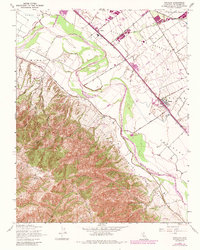
1947 Map of Chualar
USGS Topo · Published 1984About this map
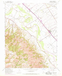
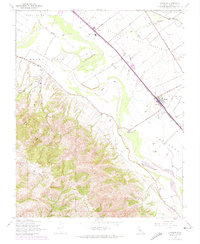
The Salinas River carves through the heart of this Salinas Valley landscape, defining the agricultural and transport corridor between the high peaks of the Sierra de Salinas and the Gabilan Range. The settlement of Chualar sits as a primary hub along the Southern Pacific railroad, surrounded by expansive land grants such as Zanjones and Buena Esperanza. This mid-century survey, photorevised in the 1980s, documents the transition of the valley floor from traditional ranching boundaries like the Llano De Buena Vista toward more intensive irrigation, evidenced by numerous Reservoirs and agricultural developments near Spence. In the western uplands, the Mt Toro Lookout Station overlooks the deep drainage of Limekiln Creek, while the Buena Vista School serves the rural population living along River Road. The map effectively captures the persistent geometry of old Spanish land grants as they interact with modern industrial rail and water infrastructure.
Find a feature on this map
24 named features on this map. Tap any name to fly to it.
Don’t see what you’re looking for? This feature index may not catch every label — zoom into the map to look around manually.
Map Details
Editions of this 1947 Chualar Map
6 editions found
Other maps of this area

1910 · Gonzales
USGS Topo · 1:31,680

1910 · Salinas
USGS Topo · 1:31,680

1910 · Soledad
USGS Topo · 1:31,680

1912 · Salinas
USGS Topo · 1:62,500

1915 · Soledad
USGS Topo · 1:62,500

1920 · Jamesburg
USGS Topo · 1:48,000

1921 · Jamesburg
USGS Topo · 1:62,500

1921 · Gonzales
USGS Topo · 1:62,500

1939 · Jamesburg
USGS Topo · 1:62,500

1940 · Salinas
USGS Topo · 1:62,500