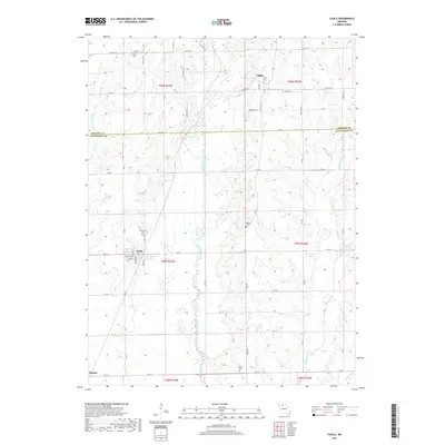
2017 Map of Chula
USGS Topo · Published 2017About this map
Chula serves as the central hub of this agricultural landscape in northern Missouri, situated at the junction of HWY K and several local routes. The town’s layout, featuring streets like Leavell St and Broadway St, reflects a classic Midwestern grid surrounded by productive farm country. The topography is defined by the winding course of Medicine Creek, which meanders through the center of the sheet, flanked by smaller tributaries such as Norman Br and Grassy Creek.
Find a feature on this map
42 named features on this map. Tap any name to fly to it.
Don’t see what you’re looking for? This feature index may not catch every label — zoom into the map to look around manually.
Map Details
Editions of this 2017 Chula Map
This is the sole edition of this map. No revisions or reprints were ever made.
Other maps of this area

1921 · Chillicothe
USGS Topo · 1:62,500

1923 · Chillicothe
USGS Topo · 1:62,500

1924 · Chula
USGS Topo · 1:62,500

1946 · Galt
USGS Topo · 1:62,500

1947 · Chula
USGS Topo · 1:62,500

1948 · Trenton
USGS Topo · 1:62,500

1949 · Galt
USGS Topo · 1:62,500

1953 · Moberly
USGS Topo · 1:250,000

1954 · Centerville
USGS Topo · 1:250,000

1954 · Moberly
USGS Topo · 1:250,000