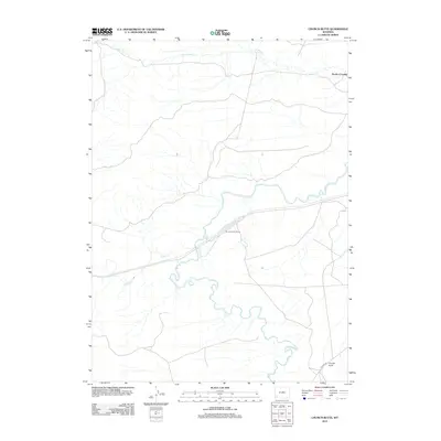
2012 Map of Church Butte
USGS Topo · Published 2012About this map
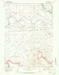
Blacks Fork winds through the high desert of southwestern Wyoming, anchoring a landscape shaped by intermittent water and early transportation corridors. The prominent landform of Church Butte stands in the southeast, serving as a landmark near Co Hwy 233. Historically significant travel routes are evidenced by Rocky Crossing on the Dry Muddy Cr, where early trails met the rugged drainage systems. The presence of the Church Buttes Siding indicates the vital role of the railroad in connecting this remote section of Uinta County to the wider region. Together with Muddy Cr, these features reveal a territory defined by the challenges of the arid basin and the infrastructure required to cross it.
Find a feature on this map
7 named features on this map. Tap any name to fly to it.
Don’t see what you’re looking for? This feature index may not catch every label — zoom into the map to look around manually.
Map Details
Editions of this 2012 Church Butte Map
This is the sole edition of this map. No revisions or reprints were ever made.
Other maps of this area

1954 · Ogden
USGS Topo · 1:250,000

1958 · Ogden
USGS Topo · 1:250,000

1960 · Ogden
USGS Topo · 1:250,000
1964 · Wildcat Butte
USGS Topo · 1:24,000

1964 · Austin Reservoir
USGS Topo · 1:24,000
1965 · Millersville
USGS Topo · 1:24,000

1969 · Church Butte NW
USGS Topo · 1:24,000
1969 · Moxa
USGS Topo · 1:24,000
1969 · Verne
USGS Topo · 1:24,000

1969 · Roberson Creek
USGS Topo · 1:24,000