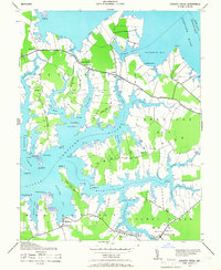
1942 Map of Church Creek
USGS Topo · Published 1966About this map
Choptank River shorelines and the intricately carved peninsulas of Dorchester County dominate this 1942 survey. The landscape is defined by its maritime orientation, where neck lands like Hudson Neck and Beckwith Neck extend into the surrounding tidal waters. Small, water-dependent communities such as Madison and Church Creek serve as anchors for the local population, connected by a network of rural roads like Town Point Road.
Find a feature on this map
65 named features on this map. Tap any name to fly to it.
Don’t see what you’re looking for? This feature index may not catch every label — zoom into the map to look around manually.
Map Details
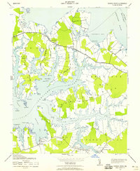
Editions of this 1942 Church Creek Map
2 editions found
Other maps of this area

1892 · Drum Point
USGS Topo · 1:62,500

1893 · Sharps Island
USGS Topo · 1:62,500

1898 · Choptank
USGS Topo · 1:125,000

1898 · St. Marys
USGS Topo · 1:125,000

1901 · Drum Point
USGS Topo · 1:62,500

1904 · Sharps Island
USGS Topo · 1:62,500

1904 · Oxford
USGS Topo · 1:62,500

1905 · Crapo
USGS Topo · 1:62,500

1905 · Drum Point
USGS Topo · 1:62,500

1906 · St. Marys
USGS Topo · 1:125,000