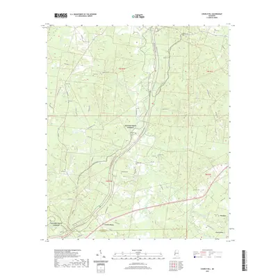
2020 Map of Church Hill
USGS Topo · Published 2020About this map
South Fork Coles Creek and its many winding tributaries like Monkey Bayou and Lum Bayou carve through the dissected terrain of the Mississippi Loess Hills north of the Jefferson and Adams County line. This modern topographic record captures the dispersed rural settlement pattern around Church Hill and Cannonsburg, where the landscape is defined more by its historical family burial grounds than by dense commercial centers. Numerous small cemeteries, including Chamberlin Cem, Bethlehem Cem, and Lee Cem, are scattered across the uplands, indicating long-standing family landholdings. The Natchez Trace Parkway and the Natchez Trace National Scenic Trail bisect the area, following the high ground between the creek drainages and preserving a corridor of historic travel through this heavily wooded portion of the state.
Find a feature on this map
67 named features on this map. Tap any name to fly to it.
Don’t see what you’re looking for? This feature index may not catch every label — zoom into the map to look around manually.
Map Details
Editions of this 2020 Church Hill Map
This is the sole edition of this map. No revisions or reprints were ever made.
Other maps of this area

1921 · Natchez
USGS Topo · 1:48,000

1922 · Natchez
USGS Topo · 1:62,500

1939 · Lorman
USGS Topo · 1:62,500

1939 · Natchez
USGS Topo · 1:62,500

1939 · Locust Ridge
USGS Topo · 1:62,500

1953 · Natchez
USGS Topo · 1:250,000

1956 · Natchez
USGS Topo · 1:250,000

1958 · St. Joseph
USGS Topo · 1:62,500

1959 · Natchez
USGS Topo · 1:250,000

1962 · Fayette
USGS Topo · 1:62,500