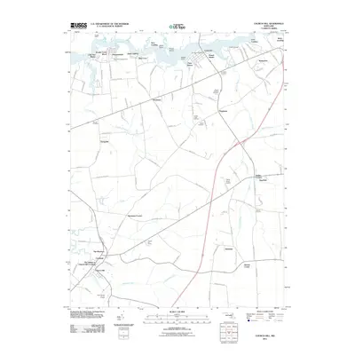
2011 Map of Church Hill
USGS Topo · Published 2011About this map
Church Hill anchors the southern portion of this landscape, where the town's historical layout meets modern residential developments like The Village at Church Hill Crossing and The Meadows. To the north, the Chester River forms a wide, meandering boundary, its banks dotted with historic access points including Spry Landing, Deep Landing, and Ford Landing. The area around Crumpton serves as a northern hub, characterized by the Crumpton Post Office and several shoreline communities such as Piney Shores.
Find a feature on this map
110 named features on this map. Tap any name to fly to it.
Don’t see what you’re looking for? This feature index may not catch every label — zoom into the map to look around manually.
Map Details
Editions of this 2011 Church Hill Map
This is the sole edition of this map. No revisions or reprints were ever made.
Other maps of this area

1898 · Tolchester
USGS Topo · 1:125,000

1899 · Dover
USGS Topo · 1:125,000

1900 · Cecilton
USGS Topo · 1:62,500

1900 · Betterton
USGS Topo · 1:62,500

1901 · Chestertown
USGS Topo · 1:62,500

1903 · Tolchester
USGS Topo · 1:125,000

1905 · Barclay
USGS Topo · 1:62,500

1906 · Dover
USGS Topo · 1:125,000

1908 · Tolchester
USGS Topo · 1:125,000

1920 · Dover
USGS Topo · 1:125,000