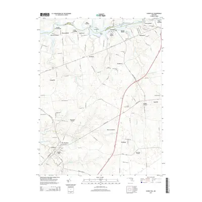
2014 Map of Church Hill
USGS Topo · Published 2014About this map
The Chester River forms the winding northern boundary of this Queen Anne's County landscape, separating it from Kent County. The riverfront is marked by numerous landings and points, including Spry Landing and Mussel Shoals, illustrating the importance of water access in this coastal plain region. Inland, the town of Church Hill serves as a primary hub, surrounded by smaller communities and residential developments like Cronshaw and Ben Lee Estates.
Find a feature on this map
129 named features on this map. Tap any name to fly to it.
Don’t see what you’re looking for? This feature index may not catch every label — zoom into the map to look around manually.
Map Details
Editions of this 2014 Church Hill Map
This is the sole edition of this map. No revisions or reprints were ever made.
Other maps of this area

1898 · Tolchester
USGS Topo · 1:125,000

1899 · Dover
USGS Topo · 1:125,000

1900 · Cecilton
USGS Topo · 1:62,500

1900 · Betterton
USGS Topo · 1:62,500

1901 · Chestertown
USGS Topo · 1:62,500

1903 · Tolchester
USGS Topo · 1:125,000

1905 · Barclay
USGS Topo · 1:62,500

1906 · Dover
USGS Topo · 1:125,000

1908 · Tolchester
USGS Topo · 1:125,000

1920 · Dover
USGS Topo · 1:125,000