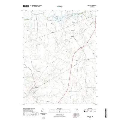
2019 Map of Church Hill
USGS Topo · Published 2019About this map
Church Hill anchors this agricultural landscape on the Upper Eastern Shore, where the headwaters of Southeast Cr and Browns Br carve through the coastal plain. In the late 2010s, this region of Queen Anne's County maintains a pattern of dispersed crossroads settlements and historic rural centers. To the north, the Chester River forms a significant boundary with Kent County, featuring prominent landmarks like Bluff Point and Chase Island. The map meticulously identifies small-scale local landmarks essential for genealogical research, including several isolated family and community burial grounds such as Thomas Cem, Double Creek Cem, and the Bethel Church Cem near Pondtown. The presence of small landing strips like Flying Acres Airport and Roseland Airport underscores the continued importance of private aviation in navigating these expansive farm stretches between Crumpton and Weidman.
Find a feature on this map
108 named features on this map. Tap any name to fly to it.
Don’t see what you’re looking for? This feature index may not catch every label — zoom into the map to look around manually.
Map Details
Editions of this 2019 Church Hill Map
This is the sole edition of this map. No revisions or reprints were ever made.
Other maps of this area

1898 · Tolchester
USGS Topo · 1:125,000

1899 · Dover
USGS Topo · 1:125,000

1900 · Cecilton
USGS Topo · 1:62,500

1900 · Betterton
USGS Topo · 1:62,500

1901 · Chestertown
USGS Topo · 1:62,500

1903 · Tolchester
USGS Topo · 1:125,000

1905 · Barclay
USGS Topo · 1:62,500

1906 · Dover
USGS Topo · 1:125,000

1908 · Tolchester
USGS Topo · 1:125,000

1920 · Dover
USGS Topo · 1:125,000