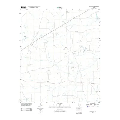
2010 Map of Church Hill
USGS Topo · Published 2010About this map
Church Hill and Chapman anchor this Rusk County landscape, which is defined by a dense network of family-named cemeteries and rural watercourses. The territory is heavily marked by the legacy of local families, visible in the distribution of the Wright Cemetery, Wasson Cemetery, and Turner Cemetery. These burial grounds are often situated near the drainage systems of Dorsett Creek and Dry Creek, reflecting early settlement patterns along the region's intermittent streams.
Find a feature on this map
33 named features on this map. Tap any name to fly to it.
Don’t see what you’re looking for? This feature index may not catch every label — zoom into the map to look around manually.
Map Details
Editions of this 2010 Church Hill Map
This is the sole edition of this map. No revisions or reprints were ever made.
Other maps of this area

1935 · Henderson
USGS Topo · 1:48,000

1936 · Kilgore
USGS Topo · 1:48,000

1939 · Henderson
USGS Topo · 1:62,500

1940 · Kilgore
USGS Topo · 1:62,500

1956 · Tyler
USGS Topo · 1:250,000

1958 · Tatum
USGS Topo · 1:62,500

1960 · Minden
USGS Topo · 1:62,500
1971 · Kilgore SE
USGS Topo · 1:24,000

1973 · Henderson
USGS Topo · 1:24,000
1973 · Berryhill Creek
USGS Topo · 1:24,000