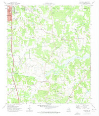
1971 Map of Kilgore SE
USGS Topo · Published 1974About this map
The eastern edges of Kilgore and the surrounding piney woods of Rusk County are defined by a landscape of intensive petroleum extraction. Numerous oil wells and gas wells dot the terrain, interspersed between agricultural clearings and small rural communities like Pirtle and New Hope. Significant civic landmarks mark the city's perimeter, including Laird Mem Hosp and St John Mem Stadium.
Find a feature on this map
40 named features on this map. Tap any name to fly to it.
Don’t see what you’re looking for? This feature index may not catch every label — zoom into the map to look around manually.
Map Details
Editions of this 1971 Kilgore SE Map
This is the sole edition of this map. No revisions or reprints were ever made.
Other maps of this area

1935 · Henderson
USGS Topo · 1:48,000

1936 · Kilgore
USGS Topo · 1:48,000

1939 · Henderson
USGS Topo · 1:62,500

1940 · Kilgore
USGS Topo · 1:62,500

1956 · Tyler
USGS Topo · 1:250,000

1958 · Tatum
USGS Topo · 1:62,500

1960 · Minden
USGS Topo · 1:62,500

1971 · Kilgore NE
USGS Topo · 1:24,000
1971 · Kilgore SW
USGS Topo · 1:24,000
1971 · Kilgore NW
USGS Topo · 1:24,000