
1971 Map of Kilgore NE
USGS Topo · Published 1974About this map
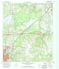
Kilgore and the southern edge of Longview anchor this East Texas landscape, where the Sabine River carves a winding path through industrial and rural developments. The map highlights a significant intersection of transport and extraction, with the Missouri Pacific railroad and extensive pipeline networks cutting across the East Field. Local centers like Kinsloe, Danville, and Fredonia appear amidst a landscape dotted with oil wells and gravel pits, illustrating the region's mid-century economic drivers. Numerous family and community landmarks, including the Utzman Cem and Post Oak Ch, provide essential context for researchers tracing local lineage. Notable educational and community sites such as Kilgore College and the Kilgore Community Airfield reflect the civic growth of Gregg County during the early 1970s.
Find a feature on this map
59 named features on this map. Tap any name to fly to it.
Don’t see what you’re looking for? This feature index may not catch every label — zoom into the map to look around manually.
Map Details
Editions of this 1971 Kilgore NE Map
2 editions found
Other maps of this area

1936 · Kilgore
USGS Topo · 1:48,000

1940 · Kilgore
USGS Topo · 1:62,500

1956 · Tyler
USGS Topo · 1:250,000

1958 · Tatum
USGS Topo · 1:62,500

1960 · White Oak
USGS Topo · 1:24,000

1960 · Gladewater
USGS Topo · 1:24,000

1962 · Longview Heights
USGS Topo · 1:24,000
1971 · Kilgore SW
USGS Topo · 1:24,000
1971 · Kilgore NW
USGS Topo · 1:24,000
1971 · Kilgore SE
USGS Topo · 1:24,000