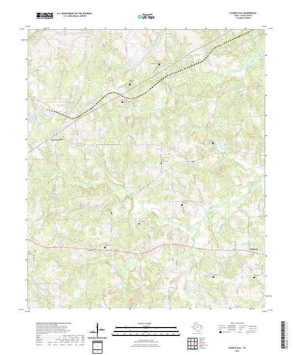
2022 Map of Church Hill
USGS Topo · Published 2022About this map
New Prospect and Chapman anchor this Rusk County landscape, which is defined by a dense network of family cemeteries and winding creeks. The terrain is marked by numerous watercourses, including Dorsett Cr and Dry Cr, that flow between small upland plateaus and private timberlands. Genealogical value is high here, with several well-preserved family burial grounds such as the Chapman Family Cem, Turner - Wasson Cem, and Craig Family Cem scattered across the countryside.
Find a feature on this map
78 named features on this map. Tap any name to fly to it.
Don’t see what you’re looking for? This feature index may not catch every label — zoom into the map to look around manually.
Map Details
Editions of this 2022 Church Hill Map
This is the sole edition of this map. No revisions or reprints were ever made.
Other maps of this area

1935 · Henderson
USGS Topo · 1:48,000

1936 · Kilgore
USGS Topo · 1:48,000

1939 · Henderson
USGS Topo · 1:62,500

1940 · Kilgore
USGS Topo · 1:62,500

1956 · Tyler
USGS Topo · 1:250,000

1958 · Tatum
USGS Topo · 1:62,500

1960 · Minden
USGS Topo · 1:62,500
1971 · Kilgore SE
USGS Topo · 1:24,000

1973 · Henderson
USGS Topo · 1:24,000
1973 · Berryhill Creek
USGS Topo · 1:24,000