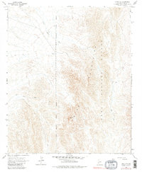
1965 Map of Cibola SE
USGS Topo · Published 1982About this map
The Trigo Mountains dominate this 1960s desert landscape, a region defined by complex topography and military activity. The eastern portion of the map is occupied by the Yuma Proving Ground, where the Military Reservation Boundary (Indefinite) marks the edge of this restricted zone. This area reveals the intersection of industrial extraction and tactical defense, with the Hart Mine and a Gravel Pit positioned near the rugged drainages of Hart Mine Wash.
Find a feature on this map
12 named features on this map. Tap any name to fly to it.
Don’t see what you’re looking for? This feature index may not catch every label — zoom into the map to look around manually.
Map Details
Editions of this 1965 Cibola SE Map
3 editions found
Other maps of this area

1934 · Trigo Peaks
USGS Topo · 1:48,000

1939 · Red Hill
USGS Topo · 1:62,500

1939 · Trigo Peaks
USGS Topo · 1:62,500

1942 · Blythe
USGS Topo · 1:250,000

1945 · Cibola
USGS Topo · 1:62,500

1945 · Picacho
USGS Topo · 1:62,500

1951 · Picacho
USGS Topo · 1:62,500

1951 · Cibola
USGS Topo · 1:62,500

1952 · Mule Wash
USGS Topo · 1:24,000

1952 · Palo Verde
USGS Topo · 1:24,000