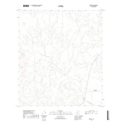
2019 Map of Cieneguita
USGS Topo · Published 2019About this map
Cibolo Creek wind through this high West Texas landscape in Presidio County, carving a drainage pattern that defines the local ranching geography. The watershed is supplemented by smaller tributaries such as Oso Cr and Cibolo Cr, illustrating the vital role of water management in this arid environment. The map details a remote transport network centered on Faver Ranch Rd and Sable Rd, which connect the scattered operations of the region. A significant landmark for modern navigation and logistics in this isolated stretch of the Trans-Pecos is the Cibolo Creek Ranch Airport, situated near the southern junction of Charco Bracero Creek Rd. This survey documents the terrain just before the turn of the decade, showing the established roads and watercourses that sustain land use in the Big Bend country.
Find a feature on this map
7 named features on this map. Tap any name to fly to it.
Don’t see what you’re looking for? This feature index may not catch every label — zoom into the map to look around manually.
Map Details
Editions of this 2019 Cieneguita Map
This is the sole edition of this map. No revisions or reprints were ever made.
Other maps of this area

1895 · Marfa
USGS Topo · 1:125,000

1896 · Shafter
USGS Topo · 1:125,000

1959 · Presidio
USGS Topo · 1:250,000

1959 · Marfa
USGS Topo · 1:250,000

1965 · Presidio
USGS Topo · 1:250,000

1965 · Marfa
USGS Topo · 1:250,000
1979 · Chinati Peak
USGS Topo · 1:24,000

1983 · Shafter
USGS Topo · 1:24,000

1983 · Cuesta Del Burro East
USGS Topo · 1:24,000

1983 · Cienega Mountains
USGS Topo · 1:24,000