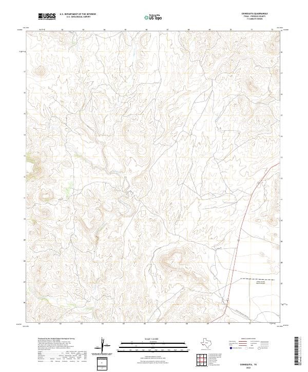
2022 Map of Cieneguita
USGS Topo · Published 2022About this map
The arid high-desert drainage of Cibolo Cr dominates this Presidio County landscape, where deep arroyos and complex contour lines reveal a terrain defined by water action in a dry climate. The ranching economy of this West Texas region is evidenced by the remote infrastructure of the Cibolo Creek Ranch Airport, which serves as a primary modern landmark in an otherwise sparsely populated area. Transportation is limited to a small network of rural corridors including Sable Rd and Fryer Ranch Rd, which cross the winding path of Cibolo Creek and smaller tributaries like Oso Cr. This survey illustrates the modern scale of land holdings and the navigational challenges of the Trans-Pecos, highlighting how contemporary ranching utilizes private airstrips and gravel roads to maintain connectivity across the desert floor.
Find a feature on this map
7 named features on this map. Tap any name to fly to it.
Don’t see what you’re looking for? This feature index may not catch every label — zoom into the map to look around manually.
Map Details
Editions of this 2022 Cieneguita Map
This is the sole edition of this map. No revisions or reprints were ever made.
Other maps of this area

1895 · Marfa
USGS Topo · 1:125,000

1896 · Shafter
USGS Topo · 1:125,000

1959 · Presidio
USGS Topo · 1:250,000

1959 · Marfa
USGS Topo · 1:250,000

1965 · Presidio
USGS Topo · 1:250,000

1965 · Marfa
USGS Topo · 1:250,000
1979 · Chinati Peak
USGS Topo · 1:24,000

1983 · Shafter
USGS Topo · 1:24,000

1983 · Cuesta Del Burro East
USGS Topo · 1:24,000

1983 · Cienega Mountains
USGS Topo · 1:24,000