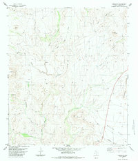
1983 Map of Cieneguita
USGS Topo · Published 1983About this map
Cibolo Creek and its complex drainage network define this Presidio County landscape as it appeared in the mid-1970s. The terrain is dominated by significant elevations such as Pico Tampico, the prominent Cerros Prietos, and the distinct formation of Elephant Rock. Evidence of ranching and land use is sparse but specific, including a Corral, a Shipping Pen, and several water sources like Black Tank and Ojo Bonito Creek that supported livestock in this arid environment.
Find a feature on this map
20 named features on this map. Tap any name to fly to it.
Don’t see what you’re looking for? This feature index may not catch every label — zoom into the map to look around manually.
Map Details
Editions of this 1983 Cieneguita Map
This is the sole edition of this map. No revisions or reprints were ever made.
Other maps of this area

1895 · Marfa
USGS Topo · 1:125,000

1896 · Shafter
USGS Topo · 1:125,000

1959 · Presidio
USGS Topo · 1:250,000

1959 · Marfa
USGS Topo · 1:250,000

1965 · Presidio
USGS Topo · 1:250,000

1965 · Marfa
USGS Topo · 1:250,000
1979 · Chinati Peak
USGS Topo · 1:24,000

1983 · Shafter
USGS Topo · 1:24,000

1983 · Cuesta Del Burro East
USGS Topo · 1:24,000

1983 · Cienega Mountains
USGS Topo · 1:24,000