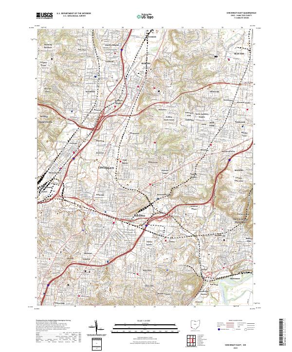
2023 Map of Cincinnati East
USGS Topo · Published 2023About this map
Reading and Wyoming anchor this densely developed corridor of Hamilton County, where industrial history meets established residential neighborhoods. The landscape is defined by the valley of Mill Creek, which served as a primary artery for the Norfolk Southern railroad and local commerce. Further east, the terrain transitions into the Rolling Hills, eventually reaching the protected corridor of the Little Miami Wild and Scenic River. This survey reveals the complex mosaic of smaller incorporated communities such as Lockland, Arlington Heights, and Lincoln Heights, highlighting the historical pattern of independent suburban growth adjacent to Cincinnati. Educational and religious institutions are prominent landmarks, including the campus of Xavier University and numerous historic burial grounds like Reading Lockland Cem and Calvary Cem. Extensive parklands, notably Ault Park, provide significant green space within the urban grid.
Find a feature on this map
335 named features on this map. Tap any name to fly to it.
Don’t see what you’re looking for? This feature index may not catch every label — zoom into the map to look around manually.
Map Details
Editions of this 2023 Cincinnati East Map
This is the sole edition of this map. No revisions or reprints were ever made.
Historical Maps of Madeira Through Time
9 maps found

1898 East Cincinnati
Hamilton County, OH
1914 East Cincinnati
Hamilton County, OH
1914 West Cincinnati
Hamilton County, OH
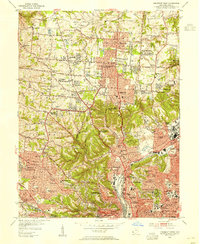
1953 Cincinnati East
Hamilton County, OH
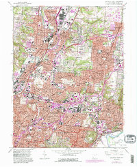
1953 Cincinnati West
Hamilton County, OH
1961 Cincinnati East
Hamilton County, OH
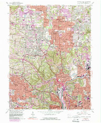
1961 Cincinnati West
Hamilton County, OH
2023 Cincinnati East
Hamilton County, OH
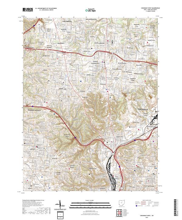
2023 Cincinnati West
Hamilton County, OH