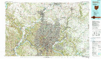
1986 Map of Cincinnati
USGS Topo · Published 1990About this map
The Ohio River corridor serves as the industrial and cultural spine of this mid-1980s tri-state survey, where the borders of Ohio, Indiana, and Kentucky converge. In the heart of Cincinnati, landmarks like Union Terminal and Riverfront Stadium anchor the urban landscape, while the sprawling grounds of Spring Grove Cem and Vine Street Hill Cem provide significant records for genealogical research. The map illustrates a dense network of transit and education, capturing the campuses of the University of Cincinnati and Xavier University alongside major rail lines including the B&O RR and L&N RR.
Find a feature on this map
173 named features on this map. Tap any name to fly to it.
Don’t see what you’re looking for? This feature index may not catch every label — zoom into the map to look around manually.
Map Details
Editions of this 1986 Cincinnati Map
3 editions found
Other maps of this area

1898 · East Cincinnati
USGS Topo · 1:62,500

1904 · Mason
USGS Topo · 1:62,500

1906 · Mason
USGS Topo · 1:62,500

1907 · Blanchester
USGS Topo · 1:62,500

1908 · Miamisburg
USGS Topo · 1:62,500

1911 · Oxford
USGS Topo · 1:62,500

1913 · Waynesville
USGS Topo · 1:62,500

1914 · East Cincinnati
USGS Topo · 1:62,500

1914 · West Cincinnati
USGS Topo · 1:62,500

1914 · Batavia
USGS Topo · 1:48,000