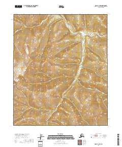
2018 Map of Circle A-1 NW
USGS Topo · Published 2018About this map
Puzzle Gulch carves through the interior of the Yukon-Koyukuk Census Area in this 2018 survey, reflecting a landscape defined by the drainage patterns of the S Fork Birch Cr system. The geography is characterized by the convergence of several significant watercourses, including the Yukon Fork S Fork Birch Cr and the winding path of Big Windy Cr. These waterways serve as the primary landmarks in an area of interior Alaska dominated by township boundaries like t5n r17e and t4n r17e. The presence of Caribou Cr further illustrates the complex hydrological network that has shaped the terrain here for generations, providing essential orientation for those navigating this unpopulated stretch of the North.
Find a feature on this map
9 named features on this map. Tap any name to fly to it.
Don’t see what you’re looking for? This feature index may not catch every label — zoom into the map to look around manually.
Map Details
Editions of this 2018 Circle A-1 NW Map
This is the sole edition of this map. No revisions or reprints were ever made.
Other maps of this area

1951 · Circle
USGS Topo · 1:250,000

1955 · Circle A-2
USGS Topo · 1:63,360

1955 · Circle A-1
USGS Topo · 1:63,360

1955 · Circle B-1
USGS Topo · 1:63,360

1955 · Circle B-2
USGS Topo · 1:63,360

1955 · Circle
USGS Topo · 1:250,000

1964 · Circle
USGS Topo · 1:250,000
2018 · Circle B-1 SE
USGS Topo · 1:25,000
2018 · Circle A-1 NE
USGS Topo · 1:25,000
2018 · Circle A-2 SE
USGS Topo · 1:25,000