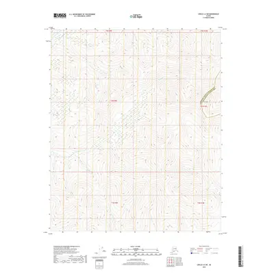
2018 Map of Circle A-4 SW
USGS Topo · Published 2018About this map
N Fork Chena River cuts across the northwest corner of this interior Alaska wilderness, serving as a primary drainage for the surrounding high-altitude terrain. The landscape is defined by its complex hydrology, with systems such as Monument Cr and Wolverine Cr flowing through steep-sided valleys towards the larger river system. Rising above these drainages is Far Mtn, a prominent peak situated along the boundary between the Fairbanks North Star Borough and the Yukon-Koyukuk Census Area. This survey provides a precise look at the township and range lines in a region lacking established roads or settlements, where the environment is shaped entirely by the elevation and the natural path of waterways like Demar Cr.
Find a feature on this map
12 named features on this map. Tap any name to fly to it.
Don’t see what you’re looking for? This feature index may not catch every label — zoom into the map to look around manually.
Map Details
Editions of this 2018 Circle A-4 SW Map
This is the sole edition of this map. No revisions or reprints were ever made.
Other maps of this area

1950 · Big Delta
USGS Topo · 1:250,000

1951 · Big Delta
USGS Topo · 1:250,000

1951 · Circle
USGS Topo · 1:250,000

1951 · Circle A-5
USGS Topo · 1:63,360

1952 · Circle A-4
USGS Topo · 1:63,360

1952 · Circle A-5
USGS Topo · 1:63,360

1954 · Circle A-5
USGS Topo · 1:63,360

1955 · Circle
USGS Topo · 1:250,000

1958 · Big Delta D-5
USGS Topo · 1:63,360

1958 · Big Delta D-4
USGS Topo · 1:63,360