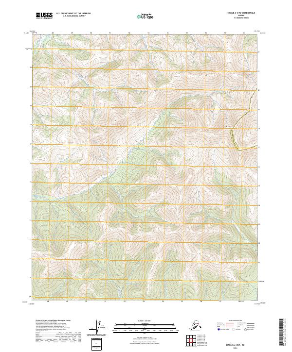
2024 Map of Circle A-4 SW
USGS Topo · Published 2024About this map
Far Mtn dominates the high-elevation terrain in this section of the Alaskan interior, marking a prominent peak near the jurisdictional boundary between the Fairbanks North Star Borough and the Yukon-Koyukuk Census Area. The landscape is defined by a dendritic drainage network, where Monument Creek and its southern tributaries, including Demar Creek and Wolverine Creek, carve through the complex topography. This survey shows a wilderness region without established roads or settlements, where the elevation contours and watercourses provide the primary navigational data. The shifting boundary lines reflect the administrative divisions of this vast interior region, captured here during the first quarter of the twenty-first century.
Find a feature on this map
11 named features on this map. Tap any name to fly to it.
Don’t see what you’re looking for? This feature index may not catch every label — zoom into the map to look around manually.
Map Details
Editions of this 2024 Circle A-4 SW Map
This is the sole edition of this map. No revisions or reprints were ever made.
Other maps of this area

1950 · Big Delta
USGS Topo · 1:250,000

1951 · Big Delta
USGS Topo · 1:250,000

1951 · Circle
USGS Topo · 1:250,000

1951 · Circle A-5
USGS Topo · 1:63,360

1952 · Circle A-4
USGS Topo · 1:63,360

1952 · Circle A-5
USGS Topo · 1:63,360

1954 · Circle A-5
USGS Topo · 1:63,360

1955 · Circle
USGS Topo · 1:250,000

1958 · Big Delta D-5
USGS Topo · 1:63,360

1958 · Big Delta D-4
USGS Topo · 1:63,360