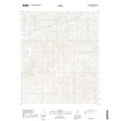
2018 Map of Circle A-6 NW
USGS Topo · Published 2018About this map
The Chatanika River dominates the northern reaches of this interior Alaskan landscape, winding through a complex network of tributary drainages. The terrain is characterized by significant topographic relief, anchored by the prominent Twin Buttes in the southwest. This area, situated within the Fairbanks North Star Borough, shows a distinct drainage pattern where numerous named creeks such as Moose Cr, Berry Cr, and Sorrels Cr carve through the uplands. The nomenclature of the landscape, including features like First Pup and Second Pup, reflects the traditional mining and prospecting vernacular common in this region of the Yukon-Tanana Uplands. While largely undeveloped, the map traces the intersection of several township lines, including t5n r4e and t4n r5e, which define the administrative grid across this remote wilderness.
Find a feature on this map
17 named features on this map. Tap any name to fly to it.
Don’t see what you’re looking for? This feature index may not catch every label — zoom into the map to look around manually.
Map Details
Editions of this 2018 Circle A-6 NW Map
This is the sole edition of this map. No revisions or reprints were ever made.
Other maps of this area

1945 · Livengood
USGS Topo · 1:250,000

1951 · Livengood
USGS Topo · 1:250,000

1951 · Circle
USGS Topo · 1:250,000

1952 · Livengood A-1
USGS Topo · 1:63,360

1954 · Circle A-6
USGS Topo · 1:63,360

1954 · Circle B-6
USGS Topo · 1:63,360

1954 · Livengood B-1
USGS Topo · 1:63,360
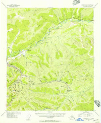
1954 · Livengood A-1
USGS Topo · 1:63,360

1955 · Circle
USGS Topo · 1:250,000

1956 · Livengood
USGS Topo · 1:250,000