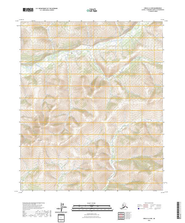
2024 Map of Circle A-6 NW
USGS Topo · Published 2024About this map
The Chatanika River winds through this interior Alaskan landscape, serving as the primary drainage for a dense network of tributaries including Buster Creek, Moose Creek, and Berry Creek. The terrain is defined by significant elevation changes, most notably at the Twin Buttes in the southwest and along the ridges flanking Sorrels Creek. Transportation in this remote area is anchored by the Steese Expressway/Highway, which provides critical access through the northern portion of the quadrangle. Local prospectors and geologists will recognize the distinctive naming conventions of the drainage system, featuring names like First Pup and Second Pup, which are characteristic of gold-bearing regions in the North Star Borough. The map detail highlights the steep valley walls of Hunter Creek and Dexter Creek, illustrating the complex hydrology of the Yukon-Tanana Uplands.
Find a feature on this map
18 named features on this map. Tap any name to fly to it.
Don’t see what you’re looking for? This feature index may not catch every label — zoom into the map to look around manually.
Map Details
Editions of this 2024 Circle A-6 NW Map
This is the sole edition of this map. No revisions or reprints were ever made.
Other maps of this area

1945 · Livengood
USGS Topo · 1:250,000

1951 · Livengood
USGS Topo · 1:250,000

1951 · Circle
USGS Topo · 1:250,000

1952 · Livengood A-1
USGS Topo · 1:63,360

1954 · Circle A-6
USGS Topo · 1:63,360

1954 · Circle B-6
USGS Topo · 1:63,360

1954 · Livengood B-1
USGS Topo · 1:63,360
1954 · Livengood A-1
USGS Topo · 1:63,360

1955 · Circle
USGS Topo · 1:250,000

1956 · Livengood
USGS Topo · 1:250,000