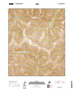
2018 Map of Circle B-3 NE
USGS Topo · Published 2018About this map
Harrison Creek Road serves as the primary corridor through this high-latitude terrain, winding along the drainage divide between the Harrison Fork and Boulder Cr. The landscape is defined by a dense network of watercourses and topographical features with names that evoke the prospecting history of the Yukon-Koyukuk region. Headwaters for the N Fork Harrison Cr and Bedrock Cr dominate the drainage patterns, while steep-sided valleys such as Greenhorn Gulch and Tinhorn Gulch illustrate the localized erosion patterns of the interior. The presence of numerous small tributaries designated as "pups"—including Maiden Pup, Bender Pup, and Fortythree Pup—provides a detailed look at the fine-grained hydrography that prospectors and surveyors used to navigate this territory before more modern developments reached the area.
Find a feature on this map
20 named features on this map. Tap any name to fly to it.
Don’t see what you’re looking for? This feature index may not catch every label — zoom into the map to look around manually.
Map Details
Editions of this 2018 Circle B-3 NE Map
This is the sole edition of this map. No revisions or reprints were ever made.
Other maps of this area

1951 · Circle
USGS Topo · 1:250,000

1955 · Circle B-3
USGS Topo · 1:63,360

1955 · Circle C-3
USGS Topo · 1:63,360

1955 · Circle C-2
USGS Topo · 1:63,360

1955 · Circle B-2
USGS Topo · 1:63,360

1955 · Circle
USGS Topo · 1:250,000

1964 · Circle
USGS Topo · 1:250,000
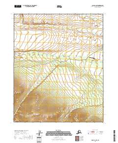
2018 · Circle C-2 SW
USGS Topo · 1:25,000
2018 · Circle B-2 NW
USGS Topo · 1:25,000
2018 · Circle B-2 SW
USGS Topo · 1:25,000