
1955 Map of Circle C-3
USGS Topo · Published 1959About this map
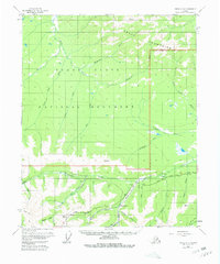
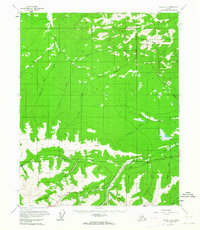
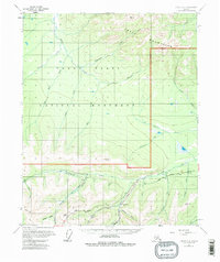
Miller House (PO) stands as a key waypoint along the Steese Highway in this mid-century survey of the Alaskan interior. The landscape is defined by the sharp rise of the Crazy Mountains to the north and a dense network of watercourses that speak to the region's mining heritage. A Placer Mine is located near the confluence of Mammoth Creek and Crooked Creek, illustrating the active resource extraction of the era. Evidence of seasonal or specialized habitation is visible in the scattered Cabin and Cabins labels found along remote drainages like Porcupine Creek. Transportation in this subarctic environment relied on the main highway and more rugged routes, such as the Tractor Trail winding through the southern hills. Numerous smaller tributaries, including Deception Pup and Stack Pup, carve through the terrain, highlighting the intricate drainage patterns essential for local prospectors and geologists.
Find a feature on this map
30 named features on this map. Tap any name to fly to it.
Don’t see what you’re looking for? This feature index may not catch every label — zoom into the map to look around manually.
Map Details
Editions of this 1955 Circle C-3 Map
4 editions found
Other maps of this area

1951 · Circle
USGS Topo · 1:250,000

1952 · Circle D-4
USGS Topo · 1:63,360

1952 · Circle D-3
USGS Topo · 1:63,360

1952 · Circle D-2
USGS Topo · 1:63,360

1952 · Circle B-4
USGS Topo · 1:63,360

1952 · Circle C-4
USGS Topo · 1:63,360

1955 · Circle B-3
USGS Topo · 1:63,360

1955 · Circle C-2
USGS Topo · 1:63,360

1955 · Circle B-2
USGS Topo · 1:63,360

1955 · Circle
USGS Topo · 1:250,000