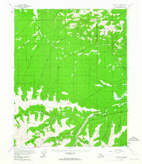
1955 Map of Circle C-3
USGS Topo · Published 1964About this map
Crazy Mountains dominate this landscape of the Yukon-Koyukuk region, where the terrain is defined by a dense network of gold-bearing drainages. The Steese Highway serves as the primary artery through the southern portion of the sheet, providing access to the Miller House post office and various mining operations. Local industry is clearly visible through features like the Placer Mine near Placer Mine Pup and the Tractor Trail winding through the southeast. The map details numerous smaller tributaries named during the prospecting era, including Bonanza Creek, Mammoth Creek, and Bedrock Creek. Scattered cabins along the watercourses suggest the seasonal or transient nature of life in the interior during the mid-1950s, while names like Deception Pup and Crooked Creek evoke the flavor of the region's mining heritage.
Find a feature on this map
33 named features on this map. Tap any name to fly to it.
Don’t see what you’re looking for? This feature index may not catch every label — zoom into the map to look around manually.
Map Details
Editions of this 1955 Circle C-3 Map
4 editions found
Other maps of this area

1951 · Circle
USGS Topo · 1:250,000

1952 · Circle D-4
USGS Topo · 1:63,360

1952 · Circle D-3
USGS Topo · 1:63,360

1952 · Circle D-2
USGS Topo · 1:63,360

1952 · Circle B-4
USGS Topo · 1:63,360

1952 · Circle C-4
USGS Topo · 1:63,360

1955 · Circle B-3
USGS Topo · 1:63,360

1955 · Circle C-3
USGS Topo · 1:63,360

1955 · Circle C-2
USGS Topo · 1:63,360

1955 · Circle B-2
USGS Topo · 1:63,360