
1955 Map of Circle C-2
USGS Topo · Published 1959About this map
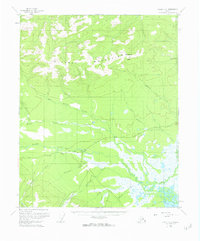
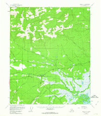
The settlement of Central serves as the focal point of this interior Alaskan landscape, situated along the Steese Highway where it meets a network of local waterways. The terrain is defined by the sharp elevations of the Crazy Mountains and Boulder Hill to the north, giving way to a complex system of gold-bearing drainages including Deadwood Creek, Crooked Creek, and Albert Creek. Evidence of resource extraction is visible throughout the lowlands, specifically at the Placer Mine sites near the highway. The infrastructure reflects the mid-century remote Alaskan interior, featuring a Landing Strip for bush pilots and several isolated Cabin structures used by miners and trappers. To the south, a Tractor Trail and Ditch network underscore the physical effort required to navigate and manage water in this high-latitude environment.
Find a feature on this map
24 named features on this map. Tap any name to fly to it.
Don’t see what you’re looking for? This feature index may not catch every label — zoom into the map to look around manually.
Map Details
Editions of this 1955 Circle C-2 Map
3 editions found
Other maps of this area

1951 · Circle
USGS Topo · 1:250,000

1952 · Circle D-3
USGS Topo · 1:63,360

1952 · Circle D-2
USGS Topo · 1:63,360

1955 · Circle B-3
USGS Topo · 1:63,360

1955 · Circle C-3
USGS Topo · 1:63,360

1955 · Circle B-1
USGS Topo · 1:63,360

1955 · Circle D-1
USGS Topo · 1:63,360

1955 · Circle B-2
USGS Topo · 1:63,360

1955 · Circle C-1
USGS Topo · 1:63,360

1955 · Circle
USGS Topo · 1:250,000