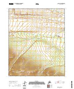
2018 Map of Circle C-2 SW
USGS Topo · Published 2018About this map
Central Airport serves as a focal point for this interior Alaskan landscape, positioned along a critical junction of transport and water. The survey reveals a terrain defined by the complex drainage of Crooked Cr and its various tributaries, including the evocative Graveyard Cr. In the southern half of the quadrangle, the high-elevation relief is carved by the headwaters of Deadwood Cr and the uniquely named Louie Pup. Human activity is primarily centered on the transit corridor of Circle Hot Springs Road, which provides access through this wilderness towards local landmarks and settlements. The presence of Deadwood Creek Road trailing off toward the southeastern corner suggests a connection to historic mining or exploration areas typically found in the Yukon-Koyukuk region.
Find a feature on this map
16 named features on this map. Tap any name to fly to it.
Don’t see what you’re looking for? This feature index may not catch every label — zoom into the map to look around manually.
Map Details
Editions of this 2018 Circle C-2 SW Map
This is the sole edition of this map. No revisions or reprints were ever made.
Other maps of this area

1951 · Circle
USGS Topo · 1:250,000

1955 · Circle B-3
USGS Topo · 1:63,360

1955 · Circle C-3
USGS Topo · 1:63,360

1955 · Circle C-2
USGS Topo · 1:63,360

1955 · Circle B-2
USGS Topo · 1:63,360

1955 · Circle
USGS Topo · 1:250,000

1964 · Circle
USGS Topo · 1:250,000
2018 · Circle C-2 SE
USGS Topo · 1:25,000
2018 · Circle B-2 NW
USGS Topo · 1:25,000
2018 · Circle B-2 NE
USGS Topo · 1:25,000