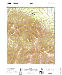
2018 Map of Circle B-2 NE
USGS Topo · Published 2018About this map
Circle Hot Springs serves as the focal point of this 2018 survey, appearing as a developed outpost in the remote Yukon-Koyukuk Census Area. The map details a small cluster of infrastructure including Circle Hot Springs Station and the Circle Hot Springs Airport, connected to the wider region by the Circle Hot Springs Road. This road network branches into several local thoroughfares like Arctic Fox Avenue and Pioneer Acres Road, reflecting a structured attempt at habitation in the interior.
Find a feature on this map
27 named features on this map. Tap any name to fly to it.
Don’t see what you’re looking for? This feature index may not catch every label — zoom into the map to look around manually.
Map Details
Editions of this 2018 Circle B-2 NE Map
This is the sole edition of this map. No revisions or reprints were ever made.
Other maps of this area

1951 · Circle
USGS Topo · 1:250,000

1955 · Circle B-1
USGS Topo · 1:63,360

1955 · Circle C-2
USGS Topo · 1:63,360

1955 · Circle B-2
USGS Topo · 1:63,360

1955 · Circle C-1
USGS Topo · 1:63,360

1955 · Circle
USGS Topo · 1:250,000

1964 · Circle
USGS Topo · 1:250,000
2018 · Circle C-2 SE
USGS Topo · 1:25,000
2018 · Circle C-2 SW
USGS Topo · 1:25,000
2018 · Circle B-2 NW
USGS Topo · 1:25,000