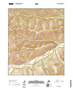
2018 Map of Circle B-3 SE
USGS Topo · Published 2018About this map
Birch Creek dominates the southern half of this landscape, carving a significant corridor through the interior wilderness of the Yukon-Koyukuk region. In the northern reaches, the drainage network of Harrison Cr is clearly defined by the N Fork Harrison Cr and S Fork Harrison Cr, which converge to feed the main stem. This area is characterized by a dense concentration of named watercourses, including Thomas Cr, Wolf Cr, and McLean Cr, suggesting a terrain shaped heavily by hydrologic flow and seasonal runoff.
Find a feature on this map
14 named features on this map. Tap any name to fly to it.
Don’t see what you’re looking for? This feature index may not catch every label — zoom into the map to look around manually.
Map Details
Editions of this 2018 Circle B-3 SE Map
This is the sole edition of this map. No revisions or reprints were ever made.
Other maps of this area

1951 · Circle
USGS Topo · 1:250,000

1955 · Circle B-3
USGS Topo · 1:63,360

1955 · Circle A-2
USGS Topo · 1:63,360

1955 · Circle A-3
USGS Topo · 1:63,360

1955 · Circle B-2
USGS Topo · 1:63,360

1955 · Circle
USGS Topo · 1:250,000

1964 · Circle
USGS Topo · 1:250,000
2018 · Circle B-2 NW
USGS Topo · 1:25,000
2018 · Circle A-2 NW
USGS Topo · 1:25,000
2018 · Circle B-2 SW
USGS Topo · 1:25,000