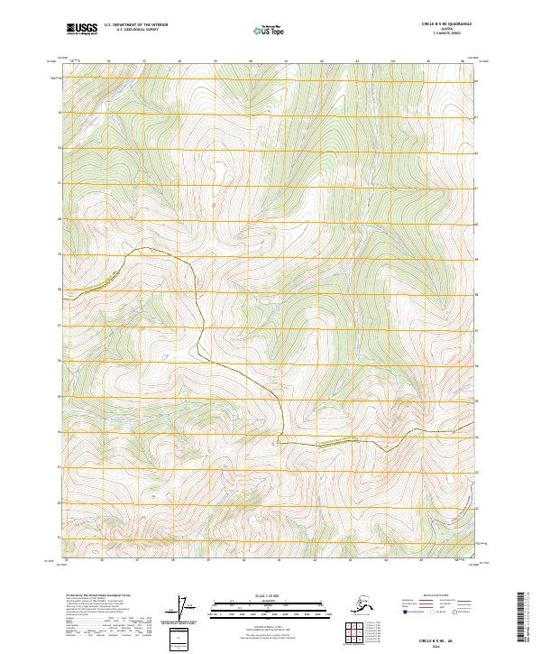
2024 Map of Circle B-5 NE
USGS Topo · Published 2024About this map
Steese National Conservation Area dominates this high-latitude terrain, where the headwaters of numerous creeks carve through the Interior Alaska landscape. The topography is defined by the drainage systems of American Creek in the north and the southward-flowing Montana Creek and McManus Creek near the southern boundary. This 2024 survey documents the modern path of the Steese Expressway/Highway, which provides the primary access through this remote corridor. The map captures the meeting of administrative boundaries, including the line between the Yukon-Koyukuk Census Area and Fairbanks North Star Borough. Tributaries such as Charity Creek and Homestake Creek illustrate the dense network of waterways that have historically drawn prospectors and outdoorsmen to the region.
Find a feature on this map
18 named features on this map. Tap any name to fly to it.
Don’t see what you’re looking for? This feature index may not catch every label — zoom into the map to look around manually.
Map Details
Editions of this 2024 Circle B-5 NE Map
This is the sole edition of this map. No revisions or reprints were ever made.
Other maps of this area

1951 · Circle
USGS Topo · 1:250,000

1952 · Circle B-4
USGS Topo · 1:63,360

1952 · Circle C-4
USGS Topo · 1:63,360

1952 · Circle C-5
USGS Topo · 1:63,360

1954 · Circle C-5
USGS Topo · 1:63,360

1954 · Circle B-5
USGS Topo · 1:63,360

1955 · Circle
USGS Topo · 1:250,000

1964 · Circle
USGS Topo · 1:250,000
2018 · Circle B-5 SW
USGS Topo · 1:25,000
2018 · Circle B-5 NE
USGS Topo · 1:25,000