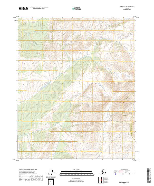
2024 Map of Circle B-6 NE
USGS Topo · Published 2024About this map
White Mountains National Recreation Area and the Steese National Conservation Area dominate this high-latitude landscape where the Yukon-Koyukuk Census Area meets the Fairbanks North Star Borough. The topography is defined by a dense network of drainages including Champion Creek, Little Champion Creek, and Moose Creek, which carve through the interior wilderness. A single terrestrial route, the Quartz Creek Trl, provides a rare point of access through the central corridor, linking the remote hydrology of Nome Creek with the northern heights. This 2024 data represents a modern record of federal land management boundaries and primitive transportation routes in a region where the natural water system remains the primary geographic marker.
Find a feature on this map
8 named features on this map. Tap any name to fly to it.
Don’t see what you’re looking for? This feature index may not catch every label — zoom into the map to look around manually.
Map Details
Editions of this 2024 Circle B-6 NE Map
This is the sole edition of this map. No revisions or reprints were ever made.
Other maps of this area

1951 · Circle
USGS Topo · 1:250,000

1951 · Circle C-6
USGS Topo · 1:63,360

1952 · Circle C-5
USGS Topo · 1:63,360

1954 · Circle C-5
USGS Topo · 1:63,360

1954 · Circle B-6
USGS Topo · 1:63,360
1954 · Circle C-6
USGS Topo · 1:63,360

1954 · Circle B-5
USGS Topo · 1:63,360

1955 · Circle
USGS Topo · 1:250,000

1964 · Circle
USGS Topo · 1:250,000
2018 · Circle B-5 SW
USGS Topo · 1:25,000