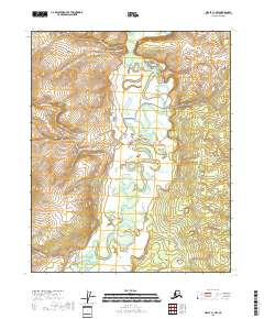
2018 Map of Circle C-1 NW
USGS Topo · Published 2018About this map
Birch Creek dominates this interior Alaska landscape, weaving a complex series of meanders and oxbows through low-lying wetlands. The waterway's intricate path is flanked by numerous tributaries, including Jumpoff Cr and Crooked Cr in the south, which drain the surrounding highlands. The terrain transitions from these broad river flats into more defined ridges where George Cr and Cheer Cr have carved narrow valleys. The absence of roads or developed settlements highlights the wilderness character of the Yukon-Koyukuk Census Area in the early 21st century. Instead, the geography is defined entirely by its hydrography, showing the natural drainage patterns of N Fork Crazy Cr and Bolgen Cr before any significant modern infrastructure altered the flow of these northern waters.
Find a feature on this map
14 named features on this map. Tap any name to fly to it.
Don’t see what you’re looking for? This feature index may not catch every label — zoom into the map to look around manually.
Map Details
Editions of this 2018 Circle C-1 NW Map
This is the sole edition of this map. No revisions or reprints were ever made.
Other maps of this area

1951 · Circle
USGS Topo · 1:250,000

1952 · Circle D-2
USGS Topo · 1:63,360

1955 · Circle C-2
USGS Topo · 1:63,360

1955 · Circle D-1
USGS Topo · 1:63,360

1955 · Circle C-1
USGS Topo · 1:63,360

1955 · Circle
USGS Topo · 1:250,000

1964 · Circle
USGS Topo · 1:250,000
2018 · Circle C-2 SE
USGS Topo · 1:25,000
2018 · Circle C-1 NE
USGS Topo · 1:25,000
2018 · Circle C-1 SE
USGS Topo · 1:25,000