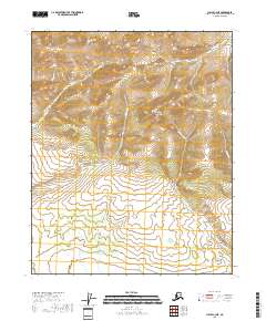
2018 Map of Circle C-3 NE
USGS Topo · Published 2018About this map
Crazy Mountains dominate this high-latitude terrain, where the elevation reaches a distinct peak at Boulder Hill. The landscape is defined by an intricate network of drainage systems feeding into larger basins, with the headwaters of Wedgewood Cr and Westover Cr carving through the northern and western reaches. To the south and east, the hydrology shifts toward the Albert Cr system, including Little Albert Cr and E Albert Cr. This 2018 survey reveals a portion of the Yukon-Koyukuk region characterized by the Public Land Survey System grids of T11N, T10N, and T9N. The lack of roads or established settlements emphasizes the interior's reliance on natural landmarks and waterways for orientation and movement through the high country.
Find a feature on this map
13 named features on this map. Tap any name to fly to it.
Don’t see what you’re looking for? This feature index may not catch every label — zoom into the map to look around manually.
Map Details
Editions of this 2018 Circle C-3 NE Map
This is the sole edition of this map. No revisions or reprints were ever made.
Other maps of this area

1951 · Circle
USGS Topo · 1:250,000

1952 · Circle D-3
USGS Topo · 1:63,360

1952 · Circle D-2
USGS Topo · 1:63,360

1955 · Circle C-3
USGS Topo · 1:63,360

1955 · Circle C-2
USGS Topo · 1:63,360

1955 · Circle
USGS Topo · 1:250,000

1964 · Circle
USGS Topo · 1:250,000
2018 · Circle D-2 SW
USGS Topo · 1:25,000
2018 · Circle C-2 SW
USGS Topo · 1:25,000
2018 · Circle C-3 NW
USGS Topo · 1:25,000