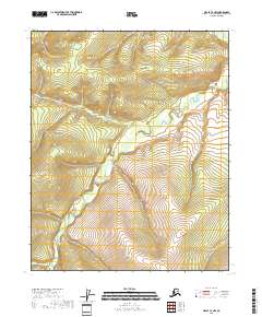
2018 Map of Circle C-4 NW
USGS Topo · Published 2018About this map
Preacher Creek winds through this interior landscape, defining the drainage patterns of the Yukon-Koyukuk Census Area. The terrain is characterized by the confluence of smaller tributaries, such as Ninetyeight Pup, which feed into the larger creek system as it flows toward the northeast. This 2018 survey by the U.S. Geological Survey illustrates a region dominated by relief and natural watercourses, with very little human-made infrastructure or settlement recorded. The mapping of these specific water bodies provides a baseline for understanding the hydrography of this sub-arctic environment, where the relationship between the local topography and the creek beds remains central to the area's geography.
Find a feature on this map
11 named features on this map. Tap any name to fly to it.
Don’t see what you’re looking for? This feature index may not catch every label — zoom into the map to look around manually.
Map Details
Editions of this 2018 Circle C-4 NW Map
This is the sole edition of this map. No revisions or reprints were ever made.
Other maps of this area

1951 · Circle
USGS Topo · 1:250,000

1952 · Circle D-4
USGS Topo · 1:63,360

1952 · Circle C-4
USGS Topo · 1:63,360

1952 · Circle D-5
USGS Topo · 1:63,360

1952 · Circle C-5
USGS Topo · 1:63,360

1954 · Circle C-5
USGS Topo · 1:63,360

1954 · Circle D-5
USGS Topo · 1:63,360

1955 · Circle
USGS Topo · 1:250,000

1964 · Circle
USGS Topo · 1:250,000
2018 · Circle C-5 NE
USGS Topo · 1:25,000