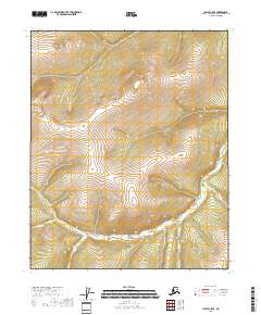
2018 Map of Circle C-5 SE
USGS Topo · Published 2018About this map
Preacher Cr and its high-elevation tributaries define this uninhabited section of the Yukon-Koyukuk region. The landscape is characterized by intricate drainage patterns where seasonal and perennial streams like American Cr and McKinley Cr carve through the interior highlands. This topographic record of the late 2010s shows a wilderness devoid of modern roads or permanent structures, reflecting the persistent isolation of the Alaska interior.
Find a feature on this map
10 named features on this map. Tap any name to fly to it.
Don’t see what you’re looking for? This feature index may not catch every label — zoom into the map to look around manually.
Map Details
Editions of this 2018 Circle C-5 SE Map
This is the sole edition of this map. No revisions or reprints were ever made.
Other maps of this area

1951 · Circle
USGS Topo · 1:250,000

1952 · Circle B-4
USGS Topo · 1:63,360

1952 · Circle C-4
USGS Topo · 1:63,360

1952 · Circle C-5
USGS Topo · 1:63,360

1954 · Circle C-5
USGS Topo · 1:63,360

1954 · Circle B-5
USGS Topo · 1:63,360

1955 · Circle
USGS Topo · 1:250,000

1964 · Circle
USGS Topo · 1:250,000
2018 · Circle B-5 NE
USGS Topo · 1:25,000
2018 · Circle B-5 NW
USGS Topo · 1:25,000