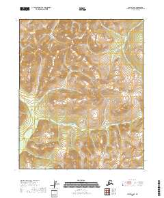
2018 Map of Circle C-6 SE
USGS Topo · Published 2018About this map
The interior of the Yukon-Koyukuk Census Area reveals a landscape defined by the convergence of several high-elevation watercourses and the survey boundaries of the Public Land Survey System. The terrain is structured by the prominent flow of Quartz Cr, which winds through the central portion of the map, and Bear Cr in the western reaches. In the southeast corner, the headwaters of Champion Cr emerge, cutting through the steep contours. This 2018 survey provides an exact record of the township and range divisions for t9n r5e, t9n r6e, t8n r5e, and t8n r6e, illustrating how the land is administratively organized in this part of Alaska despite the lack of major infrastructure or named settlements on the sheet. It serves as a definitive topographical reference for the drainage patterns of these specific creeks.
Find a feature on this map
7 named features on this map. Tap any name to fly to it.
Don’t see what you’re looking for? This feature index may not catch every label — zoom into the map to look around manually.
Map Details
Editions of this 2018 Circle C-6 SE Map
This is the sole edition of this map. No revisions or reprints were ever made.
Other maps of this area

1951 · Circle
USGS Topo · 1:250,000

1951 · Circle C-6
USGS Topo · 1:63,360

1952 · Circle C-5
USGS Topo · 1:63,360

1954 · Circle C-5
USGS Topo · 1:63,360

1954 · Circle B-6
USGS Topo · 1:63,360
1954 · Circle C-6
USGS Topo · 1:63,360

1954 · Circle B-5
USGS Topo · 1:63,360

1955 · Circle
USGS Topo · 1:250,000

1964 · Circle
USGS Topo · 1:250,000
2018 · Circle C-6 SW
USGS Topo · 1:25,000